Marjorie Harris Carr Cross Florida Greenway State Recreation and Conservation Area
The Greenway is a 110-mile linear park running across central Florida. It includes parts of the St. Johns River and the Gulf coast, and in some places is more than a mile wide. The park features more than 300 miles of trails for paddling, hiking, mountain biking, equestrian use, and paved multi-use paths. As a vital wildlife corridor, the Greenway is the first in Florida to have a “land bridge” over a major interstate, allowing both trail users and wildlife like Black Bears to cross safely. We recommend two locations on the western portion of the Greenway: Withlacoochee Bay Trail and Inglis Dam, which are about 10 minutes apart by car.
*
Sites At This Location
Withlacoochee Bay Trail
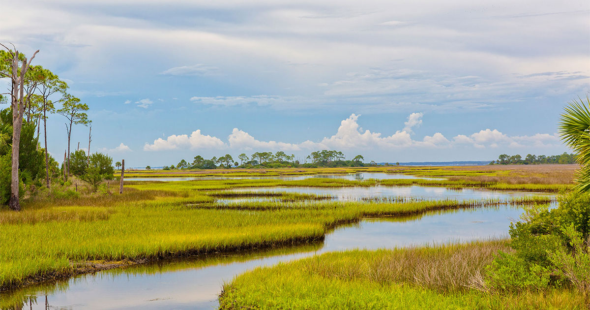
One of two GFBWT locations on the 90,000-acre, 110-mile Cross Florida Greenway, this site offers a multitude of exploration options for visitors of all mobility levels. West of the US 19 bridge is the Withlacoochee Bay Trail (WBT), a 5-mile, paved multi-use trail that follows the south shore of the Cross Florida Barge Canal, then leads through maritime hammock and salt marsh, finally ending at an observation deck on the Gulf of America.
Hours: Open all year, 8:00 AM to sunset.
Inglis Dam
Park your car at the Inglis Dam Recreation Area and boat ramp for access to the foot trails, plus Lake Rousseau, the Withlacoochee River and the Cross Florida Barge Canal. At the dam, scope the reservoir for wintering waterbirds. Cross the dam and walk north to the 1,200-acre Inglis Island, where nearly 4 miles of multi-use, unpaved loop trails lead through successional habitats including pine flatwoods, mixed hardwood hammocks and cypress swamp. A 2-mile, multi-use paved trail leads from the dam to Mullet Point, the island's northwest corner. Boat ramps above and below the dam allow for waterbird observation on both the river and the lake.
Hours: Open all year, dawn to dusk.
Withlacoochee Bay Trail
One of two GFBWT locations on the 90,000-acre, 110-mile Cross Florida Greenway, this site offers a multitude of exploration options for visitors of all mobility levels. West of the US 19 bridge is the Withlacoochee Bay Trail (WBT), a 5-mile, paved multi-use trail that follows the south shore of the Cross Florida Barge Canal, then leads through maritime hammock and salt marsh, finally ending at an observation deck on the Gulf of America. Want to bird by car? Another paved trail for vehicles parallels this trail. Numerous pull-offs allow you to take your time and soak in the surroundings. Wading birds and shorebirds frequent the shoreline and sparrows (such as Vesper, Song and Swamp) hide in vegetation along the trail edges. Bald Eagles, Mississippi Kites, Common Nighthawks and Common Ground-Doves are possible; watch for passerines in the scrubby areas near the entrance. The Eastern Pygmy-Blue butterfly occurs in the salt marsh from March to October. Along the south side of the WBT, a series of foot trails and old logging roads in the 500-acre Dixon Hammock permit observation of numerous songbird species. The coastal waters (tidal flats, estuary and salt marsh) and spoil islands directly offshore have waterfowl (including Common Goldeneyes on occasion) and shorebirds in fall/winter, including large groups of American Oystercatchers (a spotting scope is useful here). East of the bridge is the Felburn Park Trail, a 1.5-mile footpath around Phil Lake (an old quarry site).
Site Information
This Site is Free to Enter
Managed By: FL Dept. of Environmental Protection, Div. of Recreation and Parks
Operational Hours: Daily, 8 a.m. to sunset.
Size: 384 acres
Entrance
Withlacoochee Bay Trail
Address: 10201 North Suncoast Blvd., Inglis, FL 34449
View on Google Maps »
Inglis Dam
Park your car at the Inglis Dam Recreation Area and boat ramp for access to the foot trails, plus Lake Rousseau, the Withlacoochee River and the Cross Florida Barge Canal. At the dam, scope the reservoir for wintering waterbirds such as Ring-necked Duck, Greater Scaup, Ruddy Duck and Common Loon. In spring and summer, Barn Swallow nests beneath the dam. Cross the dam and walk north to the 1,200-acre Inglis Island, where nearly 4 miles of multi-use, unpaved loop trails lead through pine flatwoods, mixed hardwood hammocks and cypress swamp. A new, 2-mile, multi-use paved trail leads from the dam to Mullet Point, the island’s northwest corner. Check the edges for warblers (springtime is best) and other migratory songbirds. White-crowned, Grasshopper, Song, White-throated, Field, Chipping and Vesper Sparrows overwinter in the grassy fields. Look and listen for Chuck-will’s-widow, Common Nighthawk and Barred Owl. Limpkin and Loggerhead Shrike have turned up here, as have Pine Siskin, Le Conte’s Sparrow and Cliff Swallow. Boat ramps above and below the dam allow for waterbird observation on both the river and the lake.
Site Information
This Site is Free to Enter
Managed By: FL Dept. of Environmental Protection, Div. of Recreation and Parks
Operational Hours: Daily, 8 a.m. to sunset.
Size: 916 acres
Entrance
Inglis Dam
Address: W Riverwood Rd., Inglis, FL 34449
View on Google Maps »